Giant Tectonic Plate Under Indian Ocean is Splitting in Two
Researchers at the Institute of Earth Physics of Paris have recently discovered that the huge tectonic plate in the Indian Ocean between Australia and India is splitting up. According to the analysis the India-Australia-Capricorn tectonic plate is believed to be breaking up by 0.06 inch or 1.7 millimeters on an annual rate.
The findings were published in the journal Geophysical Research Letters. The northern Indian Ocean has been widely known as an area of largely dispersed deformation within the composite India-Australia-Capricorn plate, that hosts various diffuse boundary zones and a diffuse triple junction.
It’s not a structure that is moving fast, but it’s still significant compared to other planet boundaries…It’s like a puzzle. It’s not one uniform plate. There are three plates that are, more or less, tied together and are moving in the same direction together.
Said Aurélie Coudurier-Curveur, study’s co-researcher.
Researchers have studied the origins of the 2012 earthquake, earthquakes originated underwater near Indonesia with a magnitude of 8.6 and 8.6 on the Richter Scale, that killed 10 and injured many others.
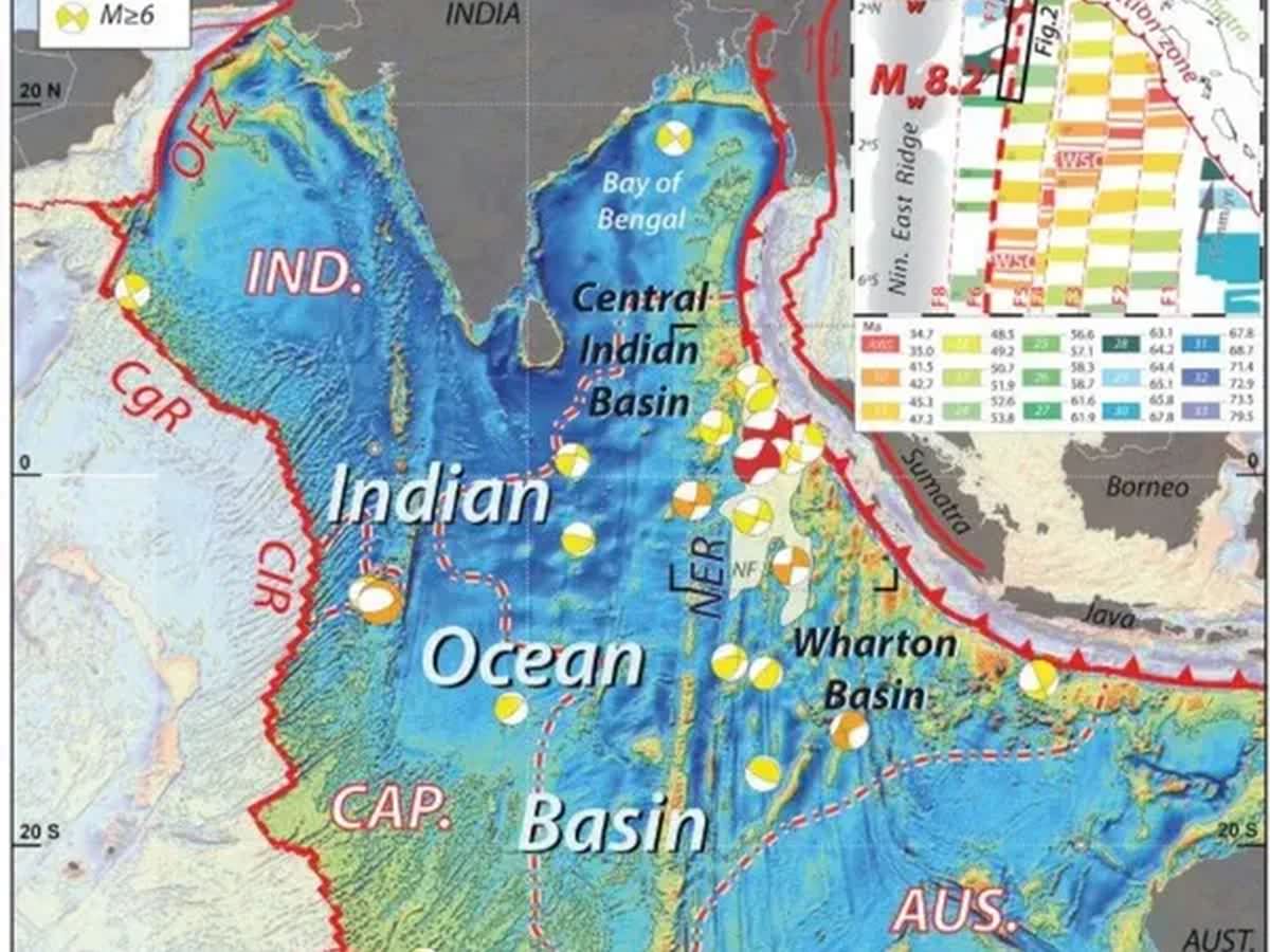
Tectonic plate under Indian Ocean is slowly splitting | Image: Aurélie Coudurier‐Curveur
These earthquakes, typical of plate boundary events, happened in the Wharton Basin, inside the India-Australia-Capricorn plate, cutting through the seafloor along straight and old fracture zones indicate that there was an active tectonic deformation taking place.
The researchers said,
Using submarine relief and seismic data, we study the freshest fracture zone (F6a) to examine whether it might qualify as a nascent plate boundary between India and Australia. We find that localised cracks along it and narrow rectangular basins (pull‐aparts) resemble those along large continental strike‐slip boundary faults, supporting the inference that the composite Indo‐Australian plate is breaking apart.
The team of researchers recorded the data for how long it took sound eaves to bounce back from the sediment-lined seafloor and bedrock. This helped them to map the Wharton Basin’s topography, where the 2012 earthquakes had originated. Two other datasets on this area that were collected by other scientists on research vessels in 2015 and 2016, also suggest the fracture zone’s topography.
When the team of researchers looked at the two datasets, they found evidence for pull-aparts, which are depressions that form at strike-slip faults. These kinds of faults cause earthquakes when two blocks of earth slide past each other horizontally.
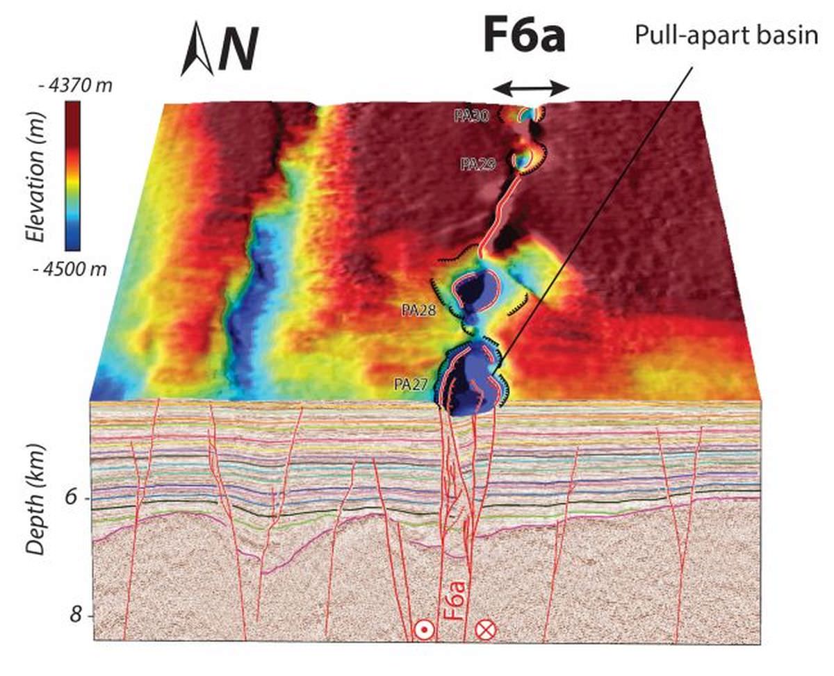
Image: Aurélie Coudurier‐Curveur
Remarkably, the team found 62 of these pull-apart basins along the mapped fracture zone, which spread nearly 350 km kilometre long. Some of these basins were massive — up to 3 kilometre wide and 8 kilometre long.
According to Coudurier-Curveur, the fracture zone did not form due to earthquakes, but because of the passive cracks that formed when new oceanic crust emerged from the mid-ocean ridge and split due to the earth’s curvature.
As different parts of the plate are moving at a distinct pace, this fracture zone is becoming the new boundary for the plate’s split into two pieces. However, the split is happening so slowly that it will take tens of millions of years for it to complete.
Via: Live Science