NASA’s AI Tree Mapping Discovers Billions of Trees in Western Africa
According to a study, researchers counted over 1.8 billion trees and shrubs in the 1.3 million square kilometer (501,933 square miles) area, which covers the western-most of the Sahara Desert, the Sahel, and the sub-humid zones of West Africa. Through AI tree mapping, researchers have found that there are billions of trees in Africa.
Scientists from NASA’s Goddard Space Flight Center in Greenbelt, Maryland, and international collaborators revealed a new method for mapping the location and size of trees growing outside of forests, which discovered billions of trees in arid and semi-arid regions and provided data for more accurate global measurement of carbon storage on land.
The researchers used detailed satellite imagery from NASA, and an advanced AI method. Normal satellite imagery is incapable to recognize individual trees; moreover, an inadequate interest in counting trees outside of forested areas led to the dominant opinion that this specific region had almost no trees. It has to be the first time that anyone calculated trees across a large dryland region.
According to Martin Brandt, a professor in the geosciences and natural resource management department at the University of Copenhagen and lead author of the study in Nature.
We were very surprised to see that quite a few trees actually grow in the Sahara Desert, because up until now, most people thought that virtually none existed. We counted hundreds of millions of trees in the desert alone. Doing so wouldn’t have been possible without this technology. Indeed, I think it marks the beginning of a new scientific era.
Brandt says that new knowledge about the existence of trees in dryland areas like this is imperative for several reasons. For instance, they signify an unknown factor when it comes to the global carbon budget.
He further added that trees outside of forested areas are typically not involved in climate models, and very little is known about their carbon stocks. They are basically a white spot on maps and an unknown component in the global carbon cycle.
Also Read: Flash Forest’s Tree-Planting Drones to Help Automate Reforestation
Furthermore, the new study contributed to getting a better grasp of the significance of trees for biodiversity and ecosystems and for the people living in these areas. In particular, improved familiarity with trees is also important for evolving programs that encourage agroforestry, which plays a major environmental and socioeconomic part in dry regions.
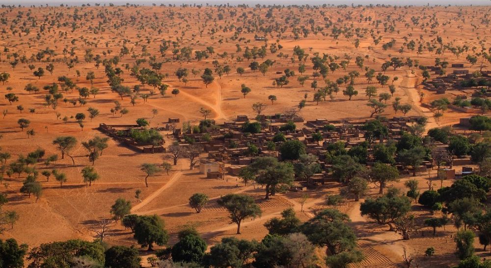
AI tree mapping found billions of trees in Africa | Image: Martin Brandt
Rasmus Fensholt, a professor in the geosciences and natural resource management department, said that this can further expand to using satellites to determine tree species, as tree types are important in relation to their value to local populations who use wood resources as part of their livelihoods.
Researchers from the University of Copenhagen’s computer science department technologically advanced the deep learning algorithm, which made the totaling of trees over such a large area possible.
The researchers provided thousands of images of various trees to the deep learning model to demonstrate what a tree looks like. The model then could identify and map trees over large areas based on the recognition of tree shapes; and needs only hours for tree mapping, which would take thousands of humans several years to achieve.
This technology has enormous potential when it comes to documenting changes on a global scale and ultimately, in contributing towards global climate goals. We are motivated to develop this type of beneficial artificial intelligence.
Says professor and coauthor Christian Igel of the computer science department.
The tree count in sub-humid zones can really help in understanding the carbon distribution in these areas, which in turn would help understand the mechanism which drives carbon storage in arid and semi-arid areas. Researchers plan to magnify the tree mapping to a much larger area in Africa. And in the long-run, they plan to create a worldwide record of all trees growing outside forested areas.