Satellite Tracks Massive Greenland Melt Amid Intense Heatwave
Copernicus Sentinel-2 satellite data shows glaciers releasing 6 billion tons of water per day into the sea between July 15 and 17, 2022
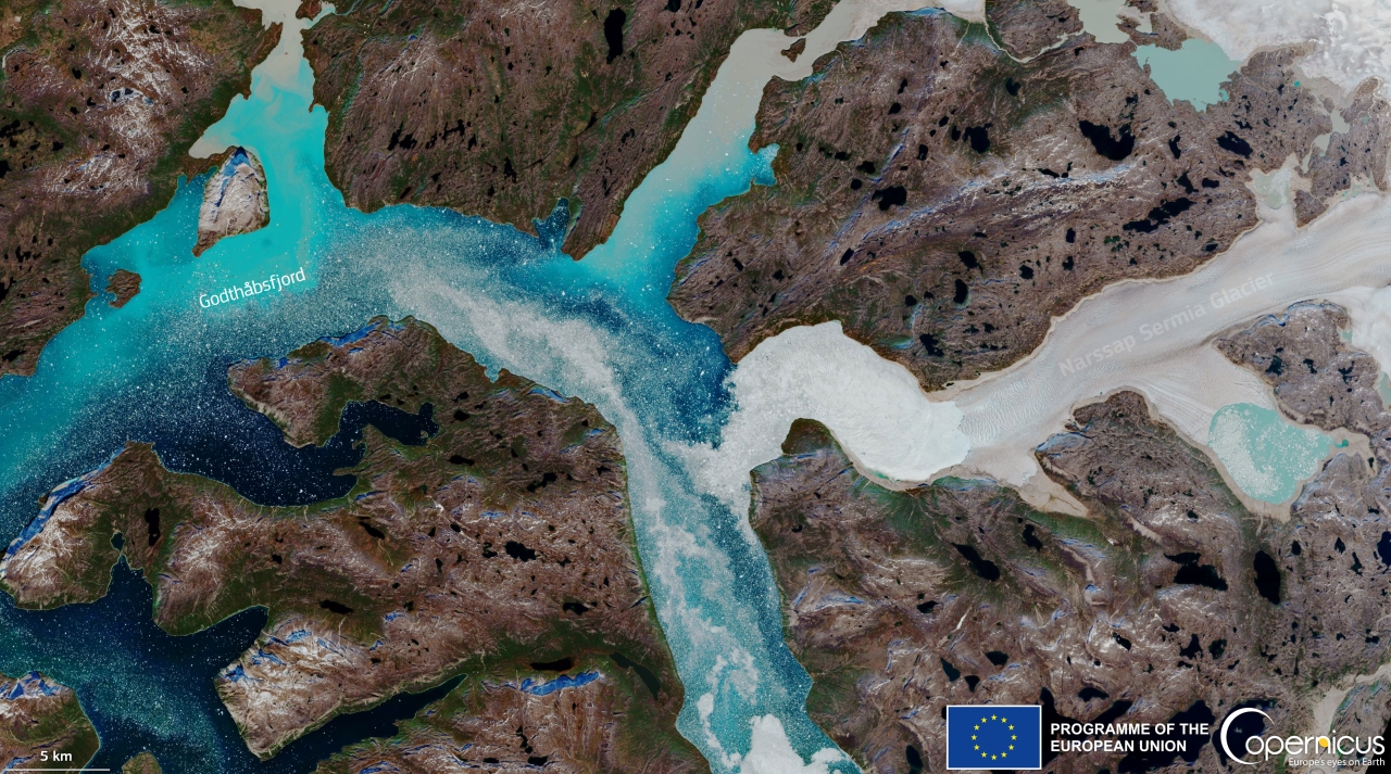
Image: European Union, Copernicus Sentinel-2
A recent satellite image from the European Union’s Copernicus Earth observation program captured horrors of climate change unfolding at the North Pole. The picture, mesmerizing at first, illustrates a massive ice melt event in Greenland amid an intense heatwave. Acquired by one of the Copernicus Sentinel-2 satellites on July 22, 2022, the image displays the high sediment release triggered by the powerful ice melt in Godthåbsfjord, in southwestern Greenland.
Copernicus data is important as it monitors the impacts of changing climatic conditions on remote and fragile ecosystems such as the Arctic regions. The several days of unusually warm weather in northern Greenland have caused rapid melting, which is visible by the rivers of meltwater hurrying toward the ocean. According to scientists, the recorded temperatures have been around 60 degrees Fahrenheit, 10 degrees warmer than normal for July.
The data from the US National Snow and Ice Data Center reveals that about 6 billion tons of water per day has been released by melting glaciers in Greenland. This amount of ice would be enough to fill 7.2 million Olympic-sized swimming pools. In other words, it was enough water to cover the entire state of West Virginia in one foot of water.
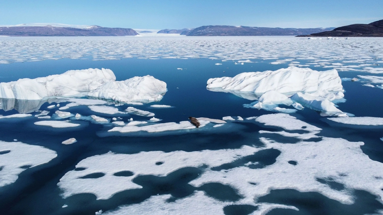
Image: Jeremy Harlan/CNN
Ted Scambos, a senior research scientist at the National Snow and Ice Data Center at the University of Colorado, said;
The northern melt this past week is not normal, looking at 30 to 40 years of climate averages. But melting has been on the increase, and this event was a spike in melt.
The unusually high temperatures caused a wide-scale snow and ice melt across Greenland’s ice sheet, which has worried glaciologists. The melting intensified even further; it took tens of thousands of years of glacial deposits along with it.
The satellite image clearly showcases the opaque, putty-colored spots running into the bright blue fjord. Godthåbsfjord is one of the largest fjord systems on the planet and these large melt anomalies are a cause for worry. It rained at the top of Greenland’s ice sheet for the first time in recorded history in 2021. Moreover, Greenland lost 532 billion tons of ice in 2019, which is the largest amount ever recorded in one year.
At the risk of stating the obvious, the country’s ice sheet melts are contributing dangerous amounts of water to global sea level rise, triggering more severe and frequent flooding across many coastal regions. If all of the ice in Greenland melts, it would increase the sea levels by 24 feet.
Via: Gizmodo